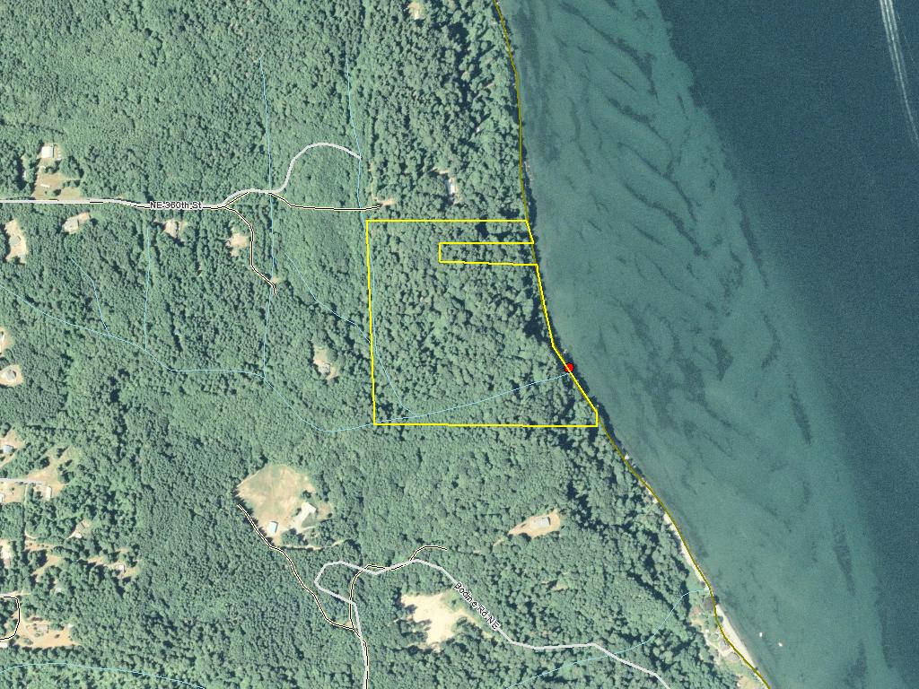
Pilot Point Fee Acquisition
This application is an opportunity to prevent the 34.5-acre Pilot Point Fee Acquisition parcel from being sold for residential development resulting in degradation of the currently excellent health of the eelgrass beds and riparian freshwater streams. Successful acquisition will protect and maintain important nearshore fish habitat for Bull trout, Chinook, chum, and coho.
Protecting Pilot Point will preserve coastal bluffs, which in turn maintains many ecological processes: sediment transport, nutrient cycling, and transfer of fresh water into the nearshore environment. The unspoiled shoreline currently supplies healthy eelgrass beds with nutrients, freshwater, and refuge vital to migrating juvenile and adult salmon survival.
Pilot Point will be sold for development for 5-6 single-family homes without conservation through acquisition. Infrastructure installation and other human impacts will greatly degrade this high quality habitat by permanently disrupting the natural landscape. Conservation of Pilot Point will protect the immediate habitat and add to the 400- plus acres of protected land along the north Kitsap shoreline. The Estuary and Salmon Restoration Program will contribute $500,000, the Salmon Recovery Funding Board will contribute $460,000 and National Coastal Wetlands Conservation Grant funding will provide the matching funds to promote salmon recovery by securing this critically positioned parcel.
|
|
General Area:
|
|
Parcel is located on Hansville Rd North.Take Right on 360th. Follow dirt road and take the left at Moyes sign (first gate with key pad) Continue to end, at gated driveway. Park on path - off the road and to right of gate. Follow path onto property.
|
|
Waterbody:
|
|
, Puget Sound
|
|
County:
|
|
Kitsap
|
|
Legislative District:
|
|
23
|
|
Congressional District 2022:
|
|
06
|
|
Salmon Recovery Regions:
|
|
Puget Sound
|
|
Watershed Administrative Unit:
|
|
Liberty-Miller-Appletree
|
|
HUC8:
|
|
Puget Sound (17110019)
|
|
WRIA:
|
|
Kitsap
|
|
Sections:
|
|
26
|
|
Sections:
|
|
27
|
|
Township:
|
|
T28NR02E
|
|
Coordinates:
|
|
47.88702973
-122.52009500
|
|
|
| Worksite Name | Scope of Work |
|
Pilot Point (#1)
|
Administrative costs (Acq), Cultural resources (Acq), Demolition, Land, Standard Incidentals
|
| | |
Amounts may not be complete
| Worksite Name | | Property Name | | Actual Acquisition
Acres | Actual Acquisition
Cost |
|
Pilot Point (#1)
|
|
Property 1 - Private Landowner
|
|
34.50
|
$2,020,754
|
| | | | Total | 34.50 | $2,020,754 |
Amounts may not be complete
| Milestone Name | Target Date | Description |
|
Project Start
|
12/13/2007
|
|
|
Order Appraisal Review(s)
|
12/13/2007
|
Complete
|
|
Environmental Clearance Rec'd
|
12/13/2007
|
Complete and on file
|
|
Demolition Complete
|
12/13/2007
|
Complete
|
|
Purchase Agreement Signed
|
04/14/2008
|
|
|
Annual Project Billing Due
|
07/31/2008
|
|
|
Special Conditions Met
|
12/01/2009
|
Exempt from EO 05-05
|
|
Survey Complete
|
12/31/2009
|
|
|
Acquisition Closing
|
12/31/2009
|
|
|
Recorded Documents to Mgmt Agy
|
12/31/2009
|
|
|
Agreement End Date
|
03/01/2011
|
|
|
Final Docs/Billing to Mgmt Agy
|
06/01/2011
|
|