Lower Quinault Invasive Plant Control (Phase 6)
 (#17-1089)
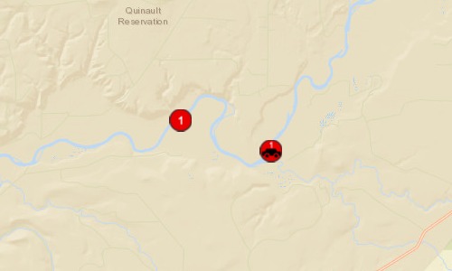
Attachment #252807, treated floodplain")
|
Quinault Indian Nation; Lower Quinault Invasive Plant Control (Phase 6) (#17-1089)
Attachment #252807, treated floodplain
|
|
|
|
|
The Quinault Division of Natural Resources will survey and treat invasive Knotweed plant species in the lower Quinault River floodplain. The project area is located in the lower Quinault River floodplain from river mile 12-18 (6 miles) to cover an area of approximately 1,892 acres. The priority Quinault River salmon species benefitting from improved floodplain forest conditions and aquatic habitats include Chinook, Chum, Coho, Sockeye, Steelhead, and Cutthroat. Of the 1,892 acres total project area surveyed, 925 acres are estimated to be infested with Knotweed and treated. Within the proposed project area, river miles (RM) 14-18 will be getting the second year of treatment. In the second year treatment area, 1,294 acres will be surveyed and an estimated 639 acres will be infested with Knotweed and treated. From RM 12-14 will be first year treatment. In the first year treatment area, 598 acres will be surveyed and an estimated 286 acres will be infested with Knotweed and treated.
|
|
General Area:
|
|
lower Quinault River, Grays Harbor County, WA
|
|
County:
|
|
Grays Harbor
|
|
Legislative District:
|
|
24
|
|
Congressional District 2022:
|
|
06
|
|
Salmon Recovery Regions:
|
|
Washington Coast
|
|
Watershed Administrative Unit:
|
|
Lower Quinault River
|
|
HUC8:
|
|
Queets-Quinault (17100102)
|
|
WRIA:
|
|
Queets - Quinault
|
|
Sections:
|
|
20
|
|
Township:
|
|
T22NR11W
|
|
Coordinates:
|
|
47.37917725
-124.09799324
|
|
|
Amounts may not be complete
| Worksite Name | | Property Name | Landowner Type |
|
Lower Quinault River Floodplain (#1)
|
|
Property 1 - Quinault Reservation
|
Tribal Government
|
| | | | Total |
Amounts may not be complete
| | Category / Work Type / Metric | Final |
Restoration Metrics (rolled up from Worksite level) |
Riparian Habitat Project |
| Riparian Plant removal / control (C.5.h.1) |
|
|
Acres of riparian treated for plant removal/control (C.5.h.3)
|
925.0
|
| Milestone Name | Target Date | Description |
|
Project Start
|
01/19/2018
|
|
|
Annual Project Billing Due
|
06/30/2018
|
|
|
Progress Report Due
|
01/02/2019
|
|
|
Progress Report Due
|
01/02/2019
|
|
|
Restoration Started
|
06/26/2019
|
|
|
Progress Report Due
|
06/30/2019
|
|
|
Annual Project Billing Due
|
06/30/2019
|
|
|
Restoration Complete
|
12/31/2019
|
|
|
Stewardship Plan to RCO
|
12/31/2019
|
|
|
Final Report Due
|
12/31/2019
|
|
|
Agreement End Date
|
12/31/2019
|
|
|
Final Billing Due
|
12/31/2019
|
|