WRIA 6 Nearshore Protection Tool Implementation

Attachment #434149, #20-1134_Photo_1.jpg")
|
Whidbey Camano Land Trust; WRIA 6 Nearshore Protection Tool Implementation (#20-1134)
Attachment #434149, #20-1134_Photo_1.jpg
|
|
|
|
|
|
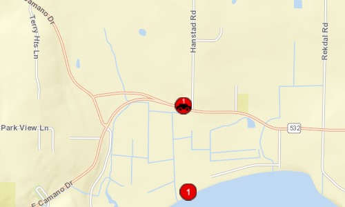
The Whidbey Camano Land Trust is seeking funds to implement the recently completed Water Resource Inventory Area (WRIA) 6 Nearshore Acquisition Prioritization Framework and conserve nearshore habitat that supports the recovery of Puget Sound salmonids, including Endangered Species Act listed Puget Sound Chinook salmon and Puget Sound steelhead. The Land Trust will use this funding to protect priority shoreline property in WRIA 6 as identified in the Nearshore Framework through fee simple and/or conservation easement acquisition. This project builds on the previously funded RCO #17-1063 Nearshore Acquisition Strategy Development project.
|
|
County:
|
|
Island
|
|
Legislative District:
|
|
10
|
|
Congressional District 2022:
|
|
02
|
|
Salmon Recovery Regions:
|
|
Puget Sound
|
|
Watershed Administrative Unit:
|
|
Camano Island
|
|
HUC8:
|
|
Puget Sound (17110019)
|
|
WRIA:
|
|
Island
|
|
Sections:
|
|
29
|
|
Township:
|
|
T32NR03E
|
|
Coordinates:
|
|
48.23464868
-122.44501066
|
|
|
| Worksite Name | Scope of Work |
|
Livingston Bay (#1)
|
Administrative costs (Acq), Agency Indirect (Acq), Appraisal, Appraisal Review, Baseline Documentation, Boundary line adjustment, Closing, Recording, Taxes, Title, Cultural resources (Acq), Environmental Audits, Fencing (Acq), Land, Noxious weed control, Signs (Acq), Stewardship plan, Survey (Acq), Wetland Delineations
|
| | |
Amounts may not be complete
| Worksite Name | | Property Name | | Proposed Acquisition
Acres | Proposed Acquisition
Cost |
|
Livingston Bay (#1)
|
|
Property 1 - Private Landowner
|
|
33.25
|
$632,371
|
|
Livingston Bay (#1)
|
|
Property 2 - Private Landowner
|
|
25.00
|
$107,500
|
| | | | Total | 58.25 | $739,871 |
Amounts may not be complete
| | Category / Work Type / Metric | Estimated |
Acquisition Metrics (rolled up from Property level) |
Real Property Acquisition |
| Land |
|
|
Acres zoned as agricultural land
|
33.25
|
| Permit Type | Applied
Date | Received
Date | Expiration
Date | Permit Number |
|
None - No permits Required
|
|
|
|
|
| Milestone Name | Target Date | Description |
|
Project Start
|
07/01/2021
|
|
|
Order Appraisal(s)
|
08/01/2021
|
Leque
|
|
Order Appraisal(s)
|
08/01/2021
|
Livingston Bay Community Association
|
|
Progress Report Due
|
10/01/2021
|
|
|
Order Appraisal Review(s)
|
11/01/2021
|
Leque
|
|
Order Appraisal Review(s)
|
11/01/2021
|
Livingston Bay Community Association
|
|
Annual Project Billing Due
|
12/15/2021
|
|
|
Baseline Documentation to RCO
|
12/31/2021
|
|
|
Progress Report Due
|
12/31/2021
|
|
|
Purchase Agreement Signed
|
03/01/2022
|
Leque
|
|
Purchase Agreement Signed
|
03/01/2022
|
Livingston Bay Community Association
|
|
Progress Report Due
|
04/30/2022
|
|
|
Environmental Assess Complete
|
06/30/2022
|
Wetland delineation (Leque)
|
|
Environmental Assess Complete
|
06/30/2022
|
Wetland delineation (Livingston Bay Community Association)
|
|
Progress Report Due
|
08/31/2022
|
|
|
Other
|
10/01/2022
|
Land Survey complete (Leque)
|
|
Other
|
10/01/2022
|
Land Survey complete (Livingston Bay Community Association)
|
|
Annual Project Billing Due
|
12/15/2022
|
|
|
Acquisition Closing
|
12/31/2022
|
Leque
|
|
Acquisition Closing
|
12/31/2022
|
Livingston Bay Community Association
|
|
Recorded Acq Documents to RCO
|
02/01/2023
|
Leque
|
|
Recorded Land Survey to RCO
|
02/01/2023
|
Leque
|
|
Recorded Acq Documents to RCO
|
02/01/2023
|
Livingston Bay Community Association
|
|
Recorded Land Survey to RCO
|
02/01/2023
|
Livingston Bay Community Association
|
|
Progress Report Due
|
04/30/2023
|
|
|
Cultural Resources Complete
|
05/01/2023
|
Leque
|
|
Cultural Resources Complete
|
05/01/2023
|
Livingston Bay Community Association
|
|
Cultural Resources Complete
|
05/01/2023
|
See special condition #1. No additional cultural resources investigation required for this phase. Future restoration phases will likely require a cultural survey.
|
|
Noxious Weed Control Complete
|
06/01/2023
|
Leque
|
|
Noxious Weed Control Complete
|
06/01/2023
|
Livingston Bay Community Association
|
|
Fencing Complete
|
08/31/2023
|
Leque
|
|
Fencing Complete
|
08/31/2023
|
Livingston Bay Community Association
|
|
Funding Acknowl Sign Posted
|
10/31/2023
|
|
|
Stewardship Plan to RCO
|
10/31/2023
|
Leque
|
|
Stewardship Plan to RCO
|
10/31/2023
|
Livingston Bay Community Association
|
|
RCO Final Inspection
|
11/30/2023
|
|
|
Final Report Due
|
11/30/2023
|
|
|
Final Billing Due
|
11/30/2023
|
|
|
Agreement End Date
|
12/31/2023
|
|
|
Other
|
12/31/2023
|
21-23 PSAR funds must be spent by 6/30/2025
|
NOTE: This data is subject to change.