DeMolay Sandspit Nature Preserve Prelim Design

Attachment #465264, Photo_Bulkhead_DeMolay.jpeg")
|
Pierce Co Conservation Dist; DeMolay Sandspit Nature Preserve Prelim Design (#21-1055)
Attachment #465264, Photo_Bulkhead_DeMolay.jpeg
|
|
|
|
|
|
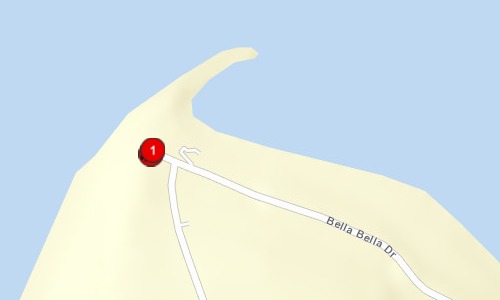
In partnership with the Peninsula Metropolitan Park District (PenMet Parks), Pierce Conservation District will complete a preliminary design for shoreline armor removal, marine riparian reconnection, and beach access improvements at the Tacoma DeMolay Sandspit Nature Preserve. The Preserve, located at the northern tip of Fox Island, Pierce County, was acquired by PenMet Parks in 2013 for public marine shoreline access and habitat protection. The Preserve encompasses over 2,000 ft of marine shoreline, approximately 600 ft of which is armored with concrete bulkhead and debris. Important habitat features on site include eelgrass beds, and documented surf smelt spawning habitat along the entirety of the Preserve (WDFW 2013). This bulkhead removal is identified as a priority nearshore project by the West Sound Lead Entity to support priority species including juvenile Puget Sound Chinook and forage fish. Shoreline armor removal will restore degraded sediment processes, reconnect mature shoreline vegetation, improve public access, support critical habitat for priority species, and act as a demonstration site for the Shore Friendly program. The project will incorporate public outreach and engagement of adjacent Fox Island landowners and video products to capture the implementation process. As a demonstration site, the project will offer Pierce County residents a local example of multi-benefit nearshore restoration.
|
|
General Area:
|
|
northern tip of Fox Island in Pierce County at the DeMolay Sandspit Nature Preserve
|
|
County:
|
|
Pierce
|
|
Legislative District:
|
|
26
|
|
Congressional District 2022:
|
|
06
|
|
Salmon Recovery Regions:
|
|
Puget Sound
|
|
Watershed Administrative Unit:
|
|
Clovos Passage/Carr Inlet
|
|
HUC8:
|
|
Puget Sound (17110019)
|
|
WRIA:
|
|
Kitsap
|
|
Sections:
|
|
27
|
|
Township:
|
|
T21NR01E
|
|
Coordinates:
|
|
47.27688985
-122.66663423
|
|
|
Amounts may not be complete
| Worksite Name | | Property Name | Landowner Type |
|
DeMolay Sandspit Nature Preserve (#1)
|
|
Property 1 - DeMolay Sandspit Nature Preserve
|
Local Government
|
| | | | Total |
Amounts may not be complete
| | Category / Work Type / Metric | Estimated |
Restoration Metrics (rolled up from Worksite level) |
|
| |
|
|
Area Encompassed (acres) (B.0.b.1)
|
1.1
|
|
|
Miles of Stream and/or Shoreline Affected (B.0.b.2)
|
0.11
|
| Permit Type | Applied
Date | Received
Date | Expiration
Date | Permit Number |
|
Hydraulics Project Approval [HPA]
|
|
|
|
|
|
SEPA
|
|
|
|
|
|
Cultural Assessment [Section 106]
|
|
|
|
|
|
Archaeological & Cultural Resources (EO 21-02)
|
|
|
|
|
|
Shoreline Permit
|
|
|
|
|
|
Dredge/Fill Permit [Section 10/404 or 404]
|
|
|
|
|