Barnabee Farms Springbrook Creek Restoration

Attachment #497030, Outlet of Barnabee Culvert.jpg")
|
Bainbridge Island Land Trust; Barnabee Farms Springbrook Creek Rest. (#24-1167)
Attachment #497030, Outlet of Barnabee Culvert.jpg
|
|
|
|
|
|
Bainbridge Island Land Trust and its partners will design, permit, and construct a project on Springbrook Cr to remove an undersized culvert that is only 67% passable to fish and remove over 187 linear ft of rock armor. Springbrook Cr, located on Bainbridge Island, is federally designated as critical habitat for ESA threated Puget Sound steelhead. A new bridge crossing, large wood, coir wraps and native vegetation will be installed along the banks where armor is removed. The project takes place on private land at stream mile 0.39. It was identified in the Springbrook Cr Watershed Assessment (SCWA) (Project 14-1547) as the second highest priority stream restoration project. It will provide fish access to over 3.76 miles of upstream fish habitat once a downstream barrier is corrected (final designs are in process), widen this section of channel to reflect natural stream conditions, improve connectivity between intact stream reaches adjacent to the existing undersized culvert, allow the stream to withstand anticipated higher flows anticipated in a changing climate, and allow for wood and sediment transport. Using the conceptual design developed by Wild Fish Conservancy (WFC) as part of the SCWA and updated May 2022, a final design will be developed with the landowner, WFC, and other stakeholders, permitting will be completed, a construction bid package will be developed, and construction will be implemented. Project success monitoring will take place for up to 3 years.
|
|
General Area:
|
|
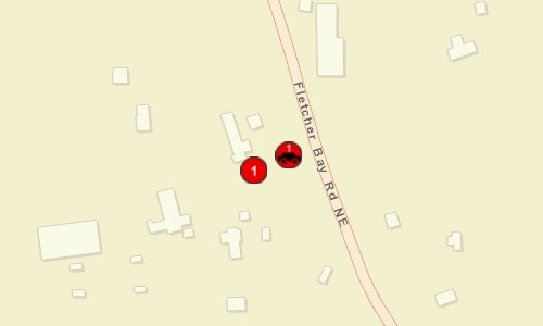
Springbrook Creek, Kitsap County WA
|
|
County:
|
|
Kitsap
|
|
Legislative District:
|
|
23
|
|
Congressional District 2022:
|
|
06
|
|
Salmon Recovery Regions:
|
|
Puget Sound
|
|
Watershed Administrative Unit:
|
|
Bainbridge Island
|
|
HUC8:
|
|
Puget Sound (17110019)
|
|
WRIA:
|
|
Kitsap
|
|
Sections:
|
|
20
|
|
Township:
|
|
T25NR02E
|
|
Coordinates:
|
|
47.64174862
-122.56480061
|
|
|
| Worksite Name | Scope of Work | Proposed Restoration Cost |
|
Barnabee Farms Springbrook Creek Restoration (#1)
|
Architectural & Engineering (A&E), Bridge installed or improved (C.2.g.1), Channel structure placement (C.4.d.1), Cultural resources, Obtain permits, Planting (C.5.c.1), Streambank stabilization (C.4.e.1)
|
$375,109
|
| | Total | $375,109 |
Amounts may not be complete
| Worksite Name | | Property Name | Landowner Type |
|
Barnabee Farms Springbrook Creek Restoration (#1)
|
|
Property 1 - Barnabee Farms
|
Private
|
| | | | Total |
Amounts may not be complete
| | Category / Work Type / Metric | Estimated |
Restoration Metrics (rolled up from Worksite level) |
Instream Habitat Project |
| Channel structure placement (C.4.d.1) |
|
|
Miles of Stream Treated for channel structure placement (C.4.d.3)
|
0.06
|
|
|
Pools Created through channel structure placement (C.4.d.5)
|
8
|
|
|
Number of structures placed in channel (C.4.d.7)
|
12
|
| Streambank stabilization (C.4.e.1) |
|
|
Miles of Streambank Stabilized (C.4.e.3)
|
0.04
|
Riparian Habitat Project |
| Planting (C.5.c.1) |
|
|
Acres Planted in riparian (C.5.c.3)
|
0.4
|
Permits |
| Obtain permits |
|
|
Number of permits required for implementation of project
|
5
|
Fish Passage Improvement |
| Bridge installed or improved (C.2.g.1) |
|
|
Number of bridges (C.2.g.2)
|
1
|
Riparian Habitat Project |
| Planting (C.5.c.1) |
|
|
Miles of streambank planted (C.5.c.4)
|
0.08
|
Fish Passage Improvement |
| |
|
|
Number of blockages / impediments / barriers impeding passage (C.2.b.4)
|
1
|
Riparian Habitat Project |
| Planting (C.5.c.1) |
|
|
Average Riparian Width
|
20
|
| Permit Type | Applied
Date | Received
Date | Expiration
Date | Permit Number |
|
Nationwide Permit
|
|
|
|
|
|
Other Required Permits
|
|
|
|
|
|
Water Quality Certification [Section 401]
|
|
|
|
|
|
SEPA
|
|
|
|
|
|
Hydraulics Project Approval [HPA]
|
|
|
|
|
|
Archaeological & Cultural Resources (EO 21-02)
|
|
|
|
|
| Attachment Type | Attachment Title | Attach Date |
|
Applicant Resolution/Authorizations
|
2023-5 BILT ApplicantAuthorizationResolutionSigned.pdf.pdf
|
04/05/2023
|
|
Application Review Report
|
Grant Manager Comments, 23-1175R(compl 05/03/23 13:10).pdf
|
05/03/2023
|
|
Application Review Report
|
Grant Manager Comments, 23-1175R(rtnd 05/02/23 15:35).pdf
|
05/02/2023
|
|
Barrier evaluation form
|
Barnabee FBRB-AppJ-BarrierEvalForm.AJFINAL.pdf.pdf
|
01/13/2022
|
|
Correction Analysis Form
|
BarnabeeFBRB-AppI-CorrectAnalysisForm.AJFINAL.pdf.pdf
|
01/13/2022
|
|
Correspondence
|
2023 updates to 2022 application.docx
|
05/03/2023
|
|
Cost Estimate
|
Revised Barnabee SRFB-Cost Estimate 5-2-2023.xlsx.xlsx
|
05/02/2023
|
|
Cost Estimate
|
22-1319 Revised BarnabeeSRFB-CostEstimate 5-31-22.xlsx.xlsx
|
05/31/2022
|
|
Cost Estimate
|
Original Barnabee FBRB-CostEstimate.xlsx.xlsx
|
03/03/2022
|
|
Cultural Resource Screening Report
|
Project Cultural Resource Screening Report (01/16/24 08:43:0.pdf
|
01/16/2024
|
|
Cultural Resource Screening Report
|
Project Cultural Resource Screening Report (10/04/22 08:28:1.pdf
|
10/04/2022
|
|
Design document
|
Barnabee Farm Design Narrative Corrected 050223.pdf
|
05/02/2023
|
|
Design document
|
Barnabee Farm Culvert and Armor Removal, Bridge Replacement,.pdf
|
05/23/2022
|
|
Design document
|
Barnabee- 30% Revd 05-2-22.pdf.pdf
|
05/23/2022
|
|
Design document
|
Conceptual Design Barnabee (Eddy) Culvert Replacement .pdf
|
01/13/2022
|
|
Map
|
Barnabee Project SCWA Aerial.pdf.pdf
|
01/12/2022
|
|
Map: Area of Potential Effect (APE)
|
Project APE Report (01/16/24 08:43:04).pdf
|
01/16/2024
|
|
Map: Area of Potential Effect (APE)
|
Project APE Report (10/04/22 08:33:03).pdf
|
10/04/2022
|
|
Map: Area of Potential Effect (APE)
|
Barnabee APE Maps 21.1542.pdf.pdf
|
01/12/2022
|
|
Map: Restoration Worksite
|
Barnabee Project in Kitsap County.pdf.pdf
|
01/12/2022
|
|
Map: Restoration Worksite
|
Barnabee Project Aerial.pdf.pdf
|
01/12/2022
|
|
Photo
|
unnatural upstream channel.jpg.jpg
|
05/23/2022
|
|
Photo
|
Road Fill illustration.jpg.jpg
|
05/23/2022
|
|
Photo
|
IMG_9738.jpg.jpg
|
05/23/2022
|
|
Photo
|
former picnic area fill and armor.jpg.jpg
|
05/23/2022
|
|
Photo
|
former left bank bridge abutment.jpg.jpg
|
05/23/2022
|
|
Photo
|
downstream of culvert.jpg.jpg
|
05/23/2022
|
|
Photo
|
close up of channelized stream.jpg.jpg
|
05/23/2022
|
|
Photo
|
channelized stream, fill, armor picnic.jpg.jpg
|
05/23/2022
|
|
Photo
|
below culvert stream shape.jpg.jpg
|
05/23/2022
|
|
Photo
|
below culvert stream config.jpg.jpg
|
05/23/2022
|
|
Photo
|
Culvert looking upstream.jpg.jpg
|
05/23/2022
|
|
Photo
|
upstream of culvert.jpg.jpg
|
05/23/2022
|
|
Photo
|
upstream constrained channel.jpg.jpg
|
05/23/2022
|
|
Photo
|
Barnabee Stairs and Footbridge to constructed bench.JPG.jpg
|
01/13/2022
|
|
Photo
|
Barnabee Constructed Bench picnic area.JPG.jpg
|
01/13/2022
|
|
Photo
|
Barnabee Armored and constrained channel downstream of culve.jpg
|
01/13/2022
|
|
Photo - downstream outlet
|
Outlet of Barnabee Culvert.jpg.jpg
|
01/13/2022
|
|
Photo - upstream habitat
|
Upstream of Barnabee Culvert Stream Conditions.jpg.jpg
|
01/13/2022
|
|
Project Application Report
|
Project Application Report, 23-1175R (sub 01/16/24 08:43:02).pdf
|
01/16/2024
|
|
Project Application Report
|
Project Application Report, 23-1175R (sub 05/02/23 16:43:10).pdf
|
05/02/2023
|
|
Project Application Report
|
Project Application Report, 23-1175R (sub 04/05/23 20:22:16).pdf
|
04/05/2023
|
|
Project Review Comments
|
Proj Review Comments LE, 23-1175R(compl 01/16/24 08:42).pdf
|
01/16/2024
|
|
Project Review Comments
|
Proj Review Comments Initial, 23-1175R(compl 01/16/24 08:42).pdf
|
01/16/2024
|
|
Project Review Comments
|
Project Review Comments Report, 22-1319R (02/28/22 10:36:00).pdf
|
02/28/2022
|
|
SRFB Review Panel Comment Form
|
22-1319 review panel comments.pdf.pdf
|
05/09/2023
|
|
Visuals
|
Photos for May 2022 Conceptual Design NarrativeFINAL.pdf.pdf
|
05/23/2022
|
|
Visuals
|
Barnabee SCWA Priorities.pdf.pdf
|
01/12/2022
|
|
Visuals
|
Barnabee Project Fish Species Distributions.pdf.pdf
|
01/12/2022
|
|
WDFW barrier & screening forms
|
Fish Passage Screening Report.pdf
|
01/12/2022
|