North Creek Culvert Replacement Project
|
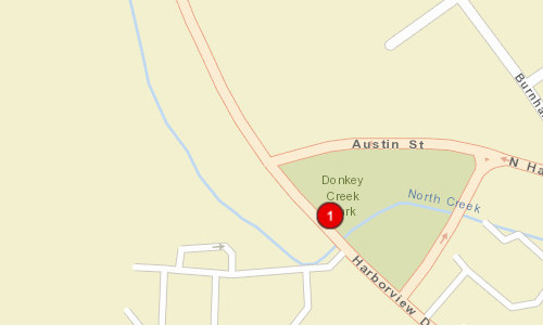
The project will replace an aging 6-ft x 6-ft x 146-ft (w x h x l) concrete box culvert that conveys the North Creek under Harborview Drive in the City of Gig Harbor, Washington. Harborview Drive appears on maps as early as 1917. The culvert is located along the apparent natural flow path of North Creek. The current box culvert was originally constructed prior to 1970. To improve fish passage at this location, a new crossing is proposed to safely convey the 100-year flood and provide suitable velocity and depth over a range of flows to allow use and passage by juvenile and adult salmonids, including Chinook, coho, steelhead, and chum. The project will remove the culvert and soil fill prism, replacing the crossing with a 45-ft x 85-ft (w x l) bridge deck that will carry two lanes of traffic, pedestrian sidewalks, and utilities, including water, sewer, and electrical. In doing this, the new crossing will provide additional benefit as a wildlife corridor and may include a pedestrian undercrossing under the road along the stream bank to connect Donkey Creek Park, as was also done at the downstream crossing at North Harborview Drive. The bridge will be supported on abutments that are spaced wide enough to accommodate the 100-year flood and the estimated 2080 climate change flood. The proposed bridge project will reconnect 0.51 miles of North Creek stream corridor to the estuary of Gig Harbor
|
|
County:
|
|
Pierce
|
|
Legislative District:
|
|
26
|
|
Congressional District 2022:
|
|
06
|
|
Salmon Recovery Regions:
|
|
Puget Sound
|
|
Watershed Administrative Unit:
|
|
Clovos Passage/Carr Inlet
|
|
HUC8:
|
|
Puget Sound (17110019)
|
|
WRIA:
|
|
Kitsap
|
|
Sections:
|
|
06
|
|
Township:
|
|
T21NR02E
|
|
Coordinates:
|
|
47.33768991
-122.59490246
|
|
|
Amounts may not be complete
| Worksite Name | | Property Name | Landowner Type |
|
Harborview Drive Right of Way, City of Gig Harbor (#1)
|
|
Property 1 - Harborview Drive ROW, City of Gig Harbor
|
Local Government
|
| | | | Total |
Amounts may not be complete
| | Category / Work Type / Metric | Estimated |
Restoration Metrics (rolled up from Worksite level) |
Fish Passage Improvement |
| Bridge installed or improved (C.2.g.1) |
|
|
Miles of stream made accessible by bridge installation/repair (C.2.g.3)
|
0.51
|
|
|
Number of bridges (C.2.g.2)
|
1
|
| |
|
|
Number of blockages / impediments / barriers impeding passage (C.2.b.4)
|
1
|
| Permit Type | Applied
Date | Received
Date | Expiration
Date | Permit Number |
|
Shoreline Permit
|
04/17/2024
|
|
|
forthcoming
|
|
Hydraulics Project Approval [HPA]
|
04/17/2024
|
|
|
forthcoming
|
|
SEPA
|
04/17/2024
|
|
|
forthcoming
|
|
Clear & Grade Permit
|
04/17/2024
|
|
|
forthcoming
|
|
Building Permit
|
07/17/2024
|
|
|
forthcoming
|
|
Endangered Species Act Compliance [ESA]
|
04/17/2024
|
|
|
forthcoming
|
|
US Army Corps of Engineers
|
04/17/2024
|
|
|
forthcoming
|
|
Other Required Permits
|
04/17/2024
|
|
|
forthcoming
|